Английская Википедия:Beit Liqya
Beit Liqya (Шаблон:Lang-ar) is a Palestinian town located in the Ramallah and al-Bireh Governorate in the northern West Bank. According to the Palestinian Central Bureau of Statistics, it had a population of approximately 9,304 in 2017.[1]
Location
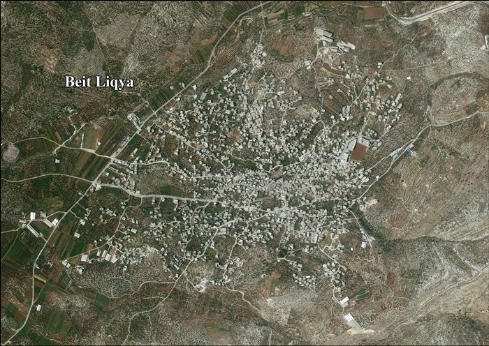
Beit Liqya is located 13.5 km southwest of Ramallah. It is bordered by Beit ‘Anan and Beit ‘Ur al Foqa to the east, Kharbatha al Misbah to the north, Beit Sira and Beit Nuba to the west, and Beit Nuba and Kharayib Umm al Lahim to the south.[2]
History
In 1882, Conder and Kitchener suggested identifying Beit Liqya with the biblical Eltekeh of Шаблон:Bibleverse.[3] However, later researchers have suggested Tel Shalaf, north of Ge'alya as the location of Eltekeh.[4][5]
It has been suggested that Beit Liqya is identical with Kefar Lekitaia, referenced in Lamentations Rabbah as one of the three stations set up by Hadrian to catch fugitives from Bethar during the Bar Kokhba revolt.[6] Safrai, on the other hand, preferred to identify Lekitaia with Khirbet el-Kutt, a ruin located 1 km south of Al-Lubban ash-Sharqiya, where a Jewish ritual bath was discovered.[7]
Medieval period
In the early 1200, the revenues from Beit Liqya were given as a waqf designated for the Al-Haram al-Sharif.[8]
Ottoman era
Beit Liqya, like the rest of Palestine, was incorporated into the Ottoman Empire in 1517. Administratively, Beit Liqya, and its two agricultural dependencies : Mazra'at Beyt Nushif and Mazra'at Rakubis, belonged to the Sub-district of Ramla in the District of Gaza. Jerusalem.[9] In 1552, the revenues of the village were designated for the new waqf of Hasseki Sultan Imaret in Jerusalem, established by Hasseki Hurrem Sultan (Roxelana), the wife of Suleiman the Magnificent.[10][11]
In 1838 Beit Lukia was noted as a Muslim village, located in the Beni Malik area, west of Jerusalem.[12]
The French explorer Victor Guérin visited the village in the 1863, and estimated that it had around five hundred inhabitants. He also noted a wali for a Sheikh Abou Ismail.[13] An official Ottoman village list from about 1870, showed that "Bet Lukja" had a total of 109 houses and a population of 347, though the population count included only men.[14][15]
In 1883, the PEF's Survey of Western Palestine described Beit Likia as a "small village on a main road at the foot of the hills, supplied by cisterns. There are ancient foundations among the houses."[3]
British Mandate era
In the 1922 census of Palestine conducted by the British Mandate authorities, Beit Leqia had a population of 739, all Muslim,[16] increasing by the time of 1931 census, when Beit Liqya had 209 occupied houses and a population of 858, still all Muslim.[17]
In the 1945 statistics the population was 1,040, all Muslims,[18] while the total land area was 14,358 dunams, according to an official land and population survey.[19] Of this, 1,918 were allocated for plantations and irrigable land, 6,469 for cereals,[20] while 39 dunams were classified as built-up (urban) areas.[21]
-
Beit Liqya 1944 1:20,000 from 1919 survey
-
Beit Liqya 1945 1:250,000 (bottom right quadrant)
Jordanian era
In the wake of the 1948 Arab–Israeli War, and after the 1949 Armistice Agreements, Beit Liqya came under Jordanian rule.
In 1961, the population of Beit Liqya was 1,727.[22]
Post-1967
Since the Six-Day War in 1967, Beit Liqya has been under Israeli occupation.
After the 1995 accords, 10.4% of the land of Beit Liqya was classified as Area B, the remaining 89.6% as Area C.[23]
Jamal 'Asi (15 years old) and U'dai 'Asi (14 years old) were killed by the Israeli Army in 2005 near the Israeli West Bank barrier.[24] UN Secretary-General Kofi Annan welcomed Israel's announcement that an involved IDF officer was suspended, and that a full investigation of the incident would take place.[25]
Later the same year, their 15-year-old cousin Mahyoub al-Asi was killed by a civilian security guard, "whom he knew." He was tending the family vineyard. His brother was also killed by a mine explosion near the village several years ago.[24]
On October 16, 2014, Israeli forces shot and killed the 13-year-old Palestinian boy Bahaa Badr in the village near the dividing line with Israel. Bahaa Badr was shot in the chest and died 20 minutes after arriving at the hospital.[26][27][28]
References
Bibliography
- Шаблон:Cite book
- Шаблон:Cite book (pp. 4,8,16,58)
- Шаблон:Cite book
- Шаблон:Cite book
- Шаблон:Cite book
- Шаблон:Cite book
- Шаблон:Citation
- Шаблон:Cite journal
- Шаблон:Cite book
- Шаблон:Cite book
- Шаблон:Cite book
- Шаблон:Cite journal
- Шаблон:Cite book
- Шаблон:Cite journal
- Шаблон:Cite journal
External links
- Welcome To Bayt Liqya
- Beit Liqya Town (Fact Sheet), Applied Research Institute–Jerusalem (ARIJ)
- Beit Liqya Town Profile, ARIJ
- Beit Liqya aerial photo, ARIJ
- Locality Development Priorities and Needs in Beit Liqya Town, ARIJ
- Survey of Western Palestine, Map 17: IAA, Wikimedia commons
- A New Israeli Military Order to confiscate ten dunums of Beit Liqya lands southwest of Ramallah city 24, April, 2010, AIRJ
Шаблон:Ramallah and al-Bireh Governorate Шаблон:Authority control
- ↑ Ошибка цитирования Неверный тег
<ref>; для сносокPrelimCensus2017не указан текст - ↑ Beit Liqya Town Profile, ARIJ, p. 4
- ↑ 3,0 3,1 Conder and Kitchener, 1881, SWP III, p. 16
- ↑ Шаблон:Cite book
- ↑ Carta's Official Guide to Israel and Complete Gazetteer to all Sites in the Holy Land. (3rd edition 1993) Jerusalem, Carta, p.163-164, Шаблон:ISBN (English)
- ↑ Шаблон:Cite book
- ↑ Klein, E, 2009, "Jewish Settlement in the Toparchy of Acraba during the Second Temple Period - The Archaeological Evidence", in: Y. Eshel (ed.), Judea and Samaria Research Studies, Volume 18, Ariel, pp. 177-200 (Hebrew).
- ↑ Shihab al-Umari, 1932, p. 49
- ↑ Шаблон:Cite journal
- ↑ Singer, 2002, p. 50, citing TSAE-7816/8. (TSAE=Topkapi Saray Arsivi, Evrak) This document reiterate what was transferred on 14 Ramazan 963 AH.
- ↑ Toledano, 1984, p. 290, has Bayt Liqya and Bayt Luqua at location 31°52′15″N 35°03′55″E .
- ↑ Robinson and Smith, 1841, vol 3, Appendix 2, p. 124
- ↑ Guérin, 1868, p. 347
- ↑ Socin, 1879, p. 146 It was also noted to be in the Beni Malik area
- ↑ Hartmann, 1883, p. 118 also noted 109 houses
- ↑ Barron, 1923, Table VII, Sub-district of Ramallah, p. 16
- ↑ Mills, 1932, p. 62.
- ↑ Government of Palestine, Department of Statistics, 1945, p. 26
- ↑ Government of Palestine, Department of Statistics. Village Statistics, April, 1945. Quoted in Hadawi, 1970, p. 64
- ↑ Government of Palestine, Department of Statistics. Village Statistics, April, 1945. Quoted in Hadawi, 1970, p. 111
- ↑ Government of Palestine, Department of Statistics. Village Statistics, April, 1945. Quoted in Hadawi, 1970, p. 161
- ↑ Government of Jordan, Department of Statistics, 1964, p. 24
- ↑ Beit Liqya Town Profile, ARIJ, pp. 16-17
- ↑ 24,0 24,1 Security guard shoots Palestinian teen in family vineyard, Jul.10, 2005, Haaretz
- ↑ Secretary-General 'saddened' by killing of two teens near Ramallah
- ↑ Palestinian boy killed by Israeli forces in West Bank Шаблон:Webarchive, Oct.16, 2014, Reuters
- ↑ Israeli Troops Are Suspected in Shooting of a Teenager, Jodi Rudoren, Oct. 16, 2014, The New York Times
- ↑ Palestinian family says it has proof boy shot by IDF troops posed no threat, By Jack Khoury, 26.10.14, Haaretz
- Страницы с неработающими файловыми ссылками
- Английская Википедия
- Towns in the West Bank
- Ramallah and al-Bireh Governorate
- Municipalities of the State of Palestine
- Страницы, где используется шаблон "Навигационная таблица/Телепорт"
- Страницы с телепортом
- Википедия
- Статья из Википедии
- Статья из Английской Википедии
- Страницы с ошибками в примечаниях