Английская Википедия:Combe Moor
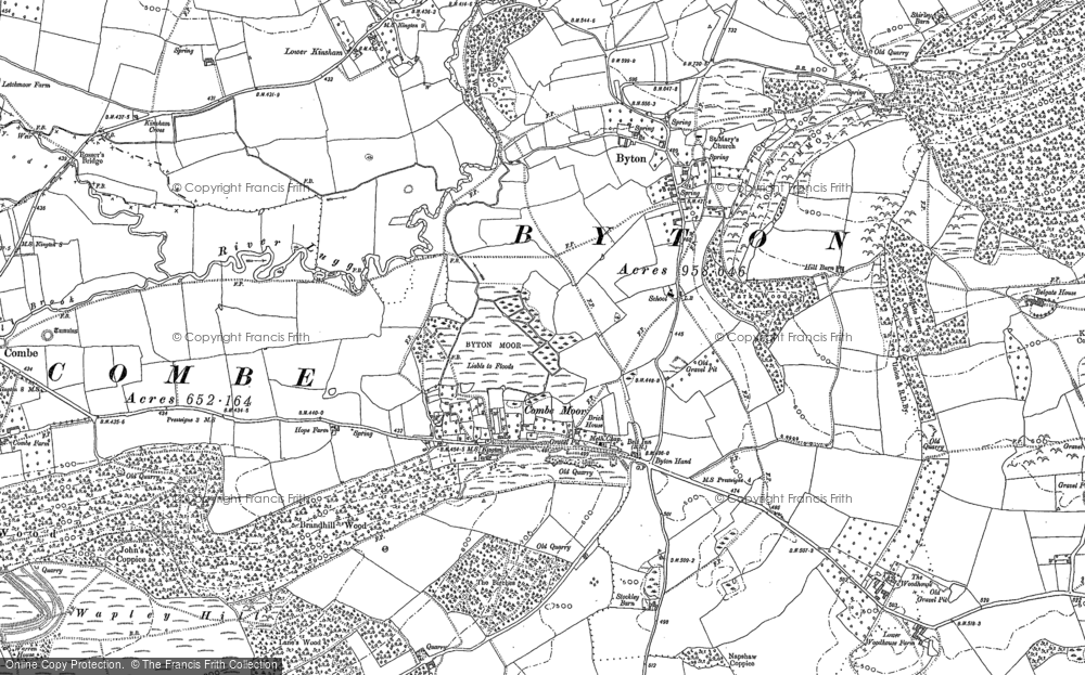
Шаблон:Short description Шаблон:Use dmy dates Шаблон:Infobox UK place Combe Moor, also known as Coombes Moor, is a linear hamlet in the civil parish of Byton in Herefordshire, England, to the south-east of the Welsh town of Presteigne,[1] near the border with Wales, and Шаблон:Convert north-west from the county town of Hereford.[2]
Geography
The village is on the B4362 road on the B4362 road between Shobdon and Presteigne near the confluence of the Hindwell Brook and the River Lugg.[3] During the Devensian period, "the eastward advance of the Wye Glacier blocked the preglacial Lugg at Combe Moor and the river cut a new course to the north-east before turning south-east through the east-to-west ridge via the Covenhope Gap."[4] Cross and Hodgson described the sediments of the Combe Moor basin in 1975 as "finely laminated and stoneless."[5]
Combe Moor lies to the south-east of Combe, just to the south-west of the village of Byton.[2] Brandhill Wood lies to the south and Park Hill to the north-east.[2] The moor to the north of the village is called Byton Moor and there is also a moor of the same name as the village just to the west of that. The Herefordshire Trail long distance footpath passes through the village.[3] Шаблон:Clear left
Landmarks
The Herefordshire Trail leads to Wapley Hillfort. There is an old schoolhouse to the north-east along the road to Byton.[3] Mistletoe House in the village is a tea room and gallery. Other cottages in the vicinity include Rue Cottage in the village itself and Wapley cottage along the lane to the south-east.[2]
References
External links