Шаблон:Infobox settlement
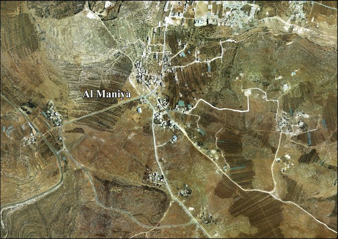
Al-Maniya (Шаблон:Lang-ar, also spelled al-Minya) is a Palestinian village in the Bethlehem Governorate in the central West Bank, 8.6 km southeast of Bethlehem and just south of Tuqu'. It incorporates the nearby hamlet of Wadi Muhammad within its jurisdiction. Most of the village, including much of its built-up area, is in Area C, giving the Israeli military full control over the village. It had a population of 1,346 in the 2017 census by the Palestinian Central Bureau of Statistics.[1]
History
The village was founded by immigrants from the southern town of Sa'ir near Hebron. According to local legend, its name derives from a cave in the vicinity that inhabited by a Byzantine-era queen named "Maniya." There is one mosque, the Palestine Mosque, in the village.[2]
French explorer Victor Guérin passed by the place in 1863, and described it as having ruins "of little importance."[3] In 1883, PEF's Survey of Western Palestine, it was described as having "foundations and ruined walls, with one or two caves, which are inhabited."[4]
In 1996, the Palestinian National Authority (PNA) established a seven-member village council to administer al-Maniya. The council members are appointed by the PNA. Principal families include al-Jabarin, al-Frookh, al-Kawazba, at-Tarwa and ash-Shalalda.[2]
References
Шаблон:Reflist
Bibliography
Шаблон:Refbegin
Шаблон:Refend
External links
Шаблон:Bethlehem Governorate
Шаблон:Authority control
| Партнерские ресурсы |
|---|
| Криптовалюты |
|
|---|
| Магазины |
|
|---|
| Хостинг |
|
|---|
| Разное |
- Викиум - Онлайн-тренажер для мозга
- Like Центр - Центр поддержки и развития предпринимательства.
- Gamersbay - лучший магазин по бустингу для World of Warcraft.
- Ноотропы OmniMind N°1 - Усиливает мозговую активность. Повышает мотивацию. Улучшает память.
- Санкт-Петербургская школа телевидения - это федеральная сеть образовательных центров, которая имеет филиалы в 37 городах России.
- Lingualeo.com — интерактивный онлайн-сервис для изучения и практики английского языка в увлекательной игровой форме.
- Junyschool (Джунискул) – международная школа программирования и дизайна для детей и подростков от 5 до 17 лет, где ученики осваивают компьютерную грамотность, развивают алгоритмическое и креативное мышление, изучают основы программирования и компьютерной графики, создают собственные проекты: игры, сайты, программы, приложения, анимации, 3D-модели, монтируют видео.
- Умназия - Интерактивные онлайн-курсы и тренажеры для развития мышления детей 6-13 лет
- SkillBox - это один из лидеров российского рынка онлайн-образования. Среди партнеров Skillbox ведущий разработчик сервисного дизайна AIC, медиа-компания Yoola, первое и самое крупное русскоязычное аналитическое агентство Tagline, онлайн-школа дизайна и иллюстрации Bang! Bang! Education, оператор PR-рынка PACO, студия рисования Draw&Go, агентство performance-маркетинга Ingate, scrum-студия Sibirix, имидж-лаборатория Персона.
- «Нетология» — это университет по подготовке и дополнительному обучению специалистов в области интернет-маркетинга, управления проектами и продуктами, дизайна, Data Science и разработки. В рамках Нетологии студенты получают ценные теоретические знания от лучших экспертов Рунета, выполняют практические задания на отработку полученных навыков, общаются с экспертами и единомышленниками. Познакомиться со всеми продуктами подробнее можно на сайте https://netology.ru, линейка курсов и профессий постоянно обновляется.
- StudyBay Brazil – это онлайн биржа для португалоговорящих студентов и авторов! Студент получает уникальную работу любого уровня сложности и больше свободного времени, в то время как у автора появляется дополнительный заработок и бесценный опыт.
- Автор24 — самая большая в России площадка по написанию учебных работ: контрольные и курсовые работы, дипломы, рефераты, решение задач, отчеты по практике, а так же любой другой вид работы. Сервис сотрудничает с более 70 000 авторов. Более 1 000 000 работ уже выполнено.
- StudyBay – это онлайн биржа для англоязычных студентов и авторов! Студент получает уникальную работу любого уровня сложности и больше свободного времени, в то время как у автора появляется дополнительный заработок и бесценный опыт.
|
|---|
- ↑ Ошибка цитирования Неверный тег
<ref>; для сносок PrelimCensus2017 не указан текст
- ↑ 2,0 2,1 Al-Maniya Village Profile. Applied Research Institute-Jerusalem. August 2010.
- ↑ Guérin 1869, p. 149
- ↑ Conder and Kitchener, 1883, SWP III, p. 359