Английская Википедия:Dura, Hebron
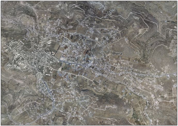
Шаблон:Short description Шаблон:Infobox settlement Dura (Шаблон:Lang-ar) is a Palestinian city located eleven kilometers southwest of Hebron, in the southern West Bank, in the Hebron Governorate of the State of Palestine. According to the Palestinian Central Bureau of Statistics, the town had a population of 39,336 in 2017.[1] The current mayor is Ahmad Salhoub.
In 1517, Dura was incorporated into the Ottoman Empire with the rest of Syria. In the late Ottoman and early Mandatory periods, Dura was the only permanent settlement in the southeastern ridge of the central highlands. Starting as a village and evolving into a town, it sprawled across large territories, becoming a center for influential families, collectively referred to as Abu-Darham.[2]
After the British Mandate, in the wake of the 1948 Arab–Israeli War, Dura came under Jordanian rule. Dura was established as a municipality on January 1, 1967, five months before it came under Israeli occupation after the Six-Day War. Since 1995, it has been governed by the Palestinian National Authority, as part of Area A of the West Bank and as part of the Hebron Governorate of the State of Palestine.
Etymology
The present-day name of Dura has been identified with ancient Adoraim or the Adora of 1 Macc.13.20[3][4][5][6] The village was originally built on two hills: Dura al-‘Amaira and Dura al-Arjan possibly reflecting dual grammatical number of Adoraim name, which could also be a double village during antiquity.[7]
History
Biblical connection
DuraШаблон:Clarify is mentioned in the Book of Chronicles (Шаблон:Bibleverse) as one of the towns fortified by Rehoboam, king of Judah.
Archaeology
Ancient cisterns and fragments of mosaics have been found at Dura.[8]
Bronze Age
The settlementШаблон:Which was mentioned in the Amarna letters as early as 14th century BC.[7][9] and in the Anastasi Papyrus.[10]
Babylonian, Hellenistic and Roman periods
After the fall of Judah to the Babylonians, the southern parts of Judea, from Adoraim to Maresha and beyond, were settled by the Edomites, who migrated to the area from southern Transjordan.[11][12] The settlement is mentioned in the Zenon Papyri in 259 BCE as a "fortress city".[13][14]
In Adora, Simon Maccabeus stopped the advancing Diodotus Tryphon army in 142 BCE.[15] According to Josephus, John Hyrcanus captured the city after the death of Antiochus VII in 129 BCE. The city inhabitants, who were alleged to have been of Esau's progeny (Idumeans), were forced to convert to Judaism during the reign of Hyrcanus, as a condition for them being allowed to remain in the country.[16]
In 63 BCE, Pompey conquered Judea. Adora became a chief place of Idumaea, Hebron no longer being important. The city is included in the list of cities rebuilt by the Roman consul Aulus Gabinius.[14] Adoraim is one of the Jewish urban centers during that period that exhibited a degree of Hellenization.[17] It may have been the administrative center of the district of Eastern Idumaea established by Gabinius, though other possibilities have been suggested.[18][19] Later, possibly in the time of Herod, the district's capital was transferred to Engeddi.[19]
A 1st century CE mansion, inhabited till the First Jewish–Roman War (66-73 CE), was partially excavated near Dura, at Khirbet Moraq. The house at the center of the estate contained a bath and consisted of rooms surrounded by an open courtyard and fronted by colonnades. According to an inscription, the house belonged to a Jewish family. This distinctive "introverted" house plan design developed in the area during the Hellenistic period.[20] The city retained its Jewish character until at least the end of the Bar Kokhba war (135 CE).[21]
Early Muslim period
Mukaddasi, writing around 985 CE, noted that Palestine was famous for its vineyards and a type of raisin called Dūrī, said to be from Dura.[22]
Ottoman period
In 1517, the village was incorporated into the Ottoman Empire with the rest of Palestine. In 1596 it appeared in the tax registers as being in the Nahiya of Khalil of the Liwa of Quds. It had a population of 49 Muslim households. The villagers paid a fixed tax rate of 33,3% on agricultural products, including on wheat, barley, olives, vines or fruit trees, and goats or beehives; a total of 10,000 akçe.[23]
According to a study by William F. Albright, Bedouins overran Dura in the 17th century. As a result, new families became the dominant ones, replacing its previous population.[24][25] Residents of several villages in the Ramallah Governorate such as At-Tira, Beit 'Anan, Beit Ur al-Fauqa, and Dura al-Qar', trace their ancestry to Dura.[26]
During the late Ottoman and early Mandatory periods, Dura stood as the sole permanent settlement in the southeastern ridge of the central highlands. Beginning as a village and evolving into a town, it expanded across extensive territories, becoming a battleground for influential families, collectively known as Abu-Darham, particularly the al-'Amr, Namura, Dudeen, and Hajji hamulas. These families, associated with the 'Amr and 'Arjan quarters, frequently quarreled for dominance. Some Abu-Darham families claimed non-native ancestry, having integrated into the village during the 18th century. Establishing alliances with Bedouin tribes proved advantageous. 'Abd al-Rahman al-'Amr, a prominent ruler, sought refuge among the Bedouin Tiaha tribe following his escape from a prison in Jerusalem after he revolted in the 1850s. This connection helped deter Bedouin incursions and facilitated peaceful territorial expansions for Dura.[27]
In 1834, Dura's inhabitants participated in an uprising against the Egyptian Ibrahim Pasha, who took over the area between 1831 and 1840. When Robinson visited in 1838, he described Dura as one of the largest villages in the area, and the residence of the Sheikhs of Ibn Omar, who had formerly ruled the area.[28]
In 1863 the French explorer Victor Guérin visited the place, and noted that "Fragments of ancient columns, and a good number of cut stones taken from old constructions and built up in the Arab houses, show the antiquity of the place. Two barracks especially have been built in this way. Above the door of one, a block forming the lintel was once ornamented with mouldings, now very much mutilated. Close to the town is a celebrated wely in which lies a colossal sarcophagus, containing, it is said, the body of Noah."[29]
An Ottoman village list from about 1870 found that Dura had a population of 420, in 144 houses, though the population count included men, only.[30][31] In 1877 Lieutenant Kitchener had some boys publicly flogged in Dura following an incident when stones were thrown at a member of the Palestine Exploration Fund survey party.[32]
In 1883, the PEF's Survey of Western Palestine described Dura as "A large and nourishing village on the flat slope of a hill, with open ground on the east for about a mile. This plain is cultivated with corn. To the north of Dura are a few olives, and others on the south. The houses are of stone. South of the village are two Mukams with white domes; and on the west, higher than the village, is the tomb of Neby Nuh (Prophet Noah). Near these there are rock-cut sepulchres. The place is well supplied from three springs on the east and one on the south."[33]
British Mandate
In 1921, a violent conflict took place between Dura and the nearby town of Ad-Dhahiriya. It was resolved through the imposition of a hefty fine of 20,000 Egyptian pounds on the "brigands" of Dura.[34]
In the 1922 census of Palestine, conducted by the British Mandate authorities, Dura was divided into Dura al-‘Amaira, with 2,565 inhabitants, and Dura al-Arjan, with 3,269 inhabitants; a total of 5,834, all Muslims.[35] The report of the 1931 census wrote that "the village in the Hebron sub-district commonly known as Dura is a congeries of neighbouring localities each of which has a distinctive name; and, while Dura is a remarkable example of neighbourly agglutination, the phenomenon is not infrequent in other villages". The total of 70 locations listed in the report had 1538 inhabited houses and a population of 7255 Muslims.[36]
In the 1945 statistics the population of Dura was 9,700, all Muslims,[37] who owned 240,704 dunams of land according to an official land and population survey.[38] 3,917 dunams were plantations and irrigable land, 90,637 for cereals,[39] while 226 dunams were built-up (urban) land.[40] Dura village lands covered in this period an estimated Шаблон:Convert, which included 99 ruined settlement sites.[41]
Jordanian rule
In the wake of the 1948 Arab–Israeli War, and after the 1949 Armistice Agreements, Dura came under Jordanian rule.
In 1961, the population of Dura was 3,852.[42]
Post-1967
Since the Six-Day War in 1967, Dura has been under Israeli occupation. The population in the 1967 census conducted by the Israeli authorities was 4,954.[43]
The municipality of Dura was established on January 1, 1967, five months before it was occupied by Israel during the Six-Day War.
After the Palestinian National Authority was ceded control of the town in 1995, a local committee was set up to prevent land confiscation from the town and the municipal council was expanded. Many Palestinian ministries and governmental institutions opened offices in Dura, enhancing its role in Palestinian politics.
In 1999, Israeli PM Ehud Barak proposed constructing a bridge linking Beit Hanoun and Dura, in order to connect the West Bank with the Gaza Strip.[44]
In 2011 the Dura International Stadium was renovated. It can hold up to 18,000 spectators and hosts national and international games.[45]
The Dura Municipal Rehabilitation Center assists Palestinian Authority residents with special needs and developmental disabilities. Occupational therapy, visual rehabilitation for the seeing impaired, and outreach program are some of the services offered.[46]
Dura has a public library, swimming pool, and a park which includes a children's theater.Шаблон:Citation needed
In June 2014, during the search to find three kidnapped boys, 150 Israeli soldiers stormed Dura's Haninia neighbourhood in a dawn raid to detain a person, and were met by young men and boys throwing rocks. An Israeli soldier shot and killed a teenager who was among the rock throwers, 13[47] or 15-year-old Mohammed Dudeen.[48][49][50]
Israeli settlement
The Israeli settlement of Adora is located 4 kilometers north of the town in the Judean Mountains[51] and has Шаблон:Israel populations inhabitants.Шаблон:Israel populations The international community considers Israeli settlements in the West Bank illegal under international law,[52] but the Israeli government dispute this. The settlement community falls under the jurisdiction of Har Hebron Regional Council.[53]
Demography
Dura is home to several clan, such as Al Swaty, Al 'Amayra, Amro, Al Sharha, Al Darweash, Al Maslamea', Al Darbeai', and Al Awawda'.[54] The Al 'Amayra (or 'Amr) clan, with families like Haji and Muhammad, has long-standing roots in Dura. They owned lands in the area and allowed migrant families to cultivate and utilized some lands as tenants.[55]
According to one account, the Maslamea' family came from Beit Jala.[55]
Another important clan in Dura is the Rajoub clan, with well-known figures like Jibril Rajoub. About 6,000 people make up this clan,[56] and they also live in nearby offshoot villages of Dura, including al-Kum, Beit Maqdum, Humsa and Ikrisa.[55] Based on one family member's account, the Rajoub family's oral tradition links their roots to a Yemenite Jew who converted to Islam centuries ago.[56]
Climate
The climate of Dura is dry in the summers and experiences moderate precipitation during winter. Average annual precipitation depend on specific geographic locations within the town. The area of Dahr Alhadaba receives an annual average of 400–600 mm of rain, southern slopes 300–400 mm and the northern region of the Dura hills 250–300.
Landmarks
A local Palestinian legend has it that the patriarch Noah, in Islamic tradition Nebi Nûh, was buried in Dura,[57] and a shrine there commemorates this Arab tradition.[58]
Notable residents
- Nabil Amr (born 1947), politician
References
Bibliography
- Шаблон:Cite book
- Шаблон:Cite book
- Шаблон:Cite book
- Шаблон:Cite book
- Шаблон:Cite book
- Шаблон:Cite book
- Шаблон:Cite book
- Шаблон:Cite book
- Шаблон:Cite book
- Шаблон:Cite journal
- Шаблон:Cite book
- Шаблон:Cite journal
- Шаблон:Cite book
- Шаблон:Cite book
- Шаблон:Cite book
- Шаблон:Cite book
- Шаблон:Cite book
- Шаблон:Cite journal
External links
- Dura municipality official website
- Welcome To The City of Dura
- Dura, Welcome to Palestine
- Survey of Western Palestine, Map 21: IAA, Wikimedia commons
- Dura Town (Fact Sheet), Applied Research Institute–Jerusalem (ARIJ)
- Dura Town Profile, ARIJ
- Dura Area Photo, ARIJ
- The priorities and needs for development in Dura town based on the community and local authorities' assessment, ARIJ
- 1946 survey with detailed plans.
Шаблон:Cities in Palestinian National Authority areas Шаблон:Hebron Governorate Шаблон:Authority control
- ↑ Ошибка цитирования Неверный тег
<ref>; для сносокPrelimCensus2017не указан текст - ↑ Шаблон:Cite book
- ↑ B. Bar-Kochva, Judas Maccabaeus: The Jewish Struggle Against the Seleucids, Cambridge University Press, 2002 p.285.
- ↑ James L. Kugel, A Walk Through Jubilees: Studies in the Book of Jubilees and the World of Its Creation, BRILL, 2012 p.303,
- ↑ Robinson and Smith, 1841, vol 3, p. 4
- ↑ Шаблон:Cite journal
- ↑ 7,0 7,1 Sharon, 2013, p. 86
- ↑ Dauphin, 1998, p. 946
- ↑ Шаблон:Cite book
- ↑ Шаблон:Cite book
- ↑ Lindsay, John. "The Babylonian kings and Edom, 605–550 BCE." Palestine Exploration Quarterly 108, no. 1 (1976): 23-39.
- ↑ Albright, William F. "Ostracon No. 6043 from Ezion-Geber." Bulletin of the American Schools of Oriental Research 82 (1941): 11-15.
- ↑ Шаблон:Cite book
- ↑ 14,0 14,1 Kanael, B. "The Partition of Judea by Gabinius". Israel Exploration Journal, vol. 7, no. 2, 1957, pp. 98–106. JSTOR, www.jstor.org/stable/27924692. Accessed 20 July 2020.
- ↑ Kraeling, Emil G. "Two Place Names of Hellenistic Palestine." Journal of Near Eastern Studies 7, no. 3 (1948): 199-201.
- ↑ Josephus, Antiquities Book xiii, chapter ix, verse 1.
- ↑ Шаблон:Cite book
- ↑ Avi-Yonah, 1977, pp. 83–84
- ↑ 19,0 19,1 Шаблон:Cite journal
- ↑ Шаблон:Cite book
- ↑ Шаблон:Cite book
- ↑ Mukaddasi, 1896, p. 69 (note 3).
- ↑ Hütteroth and Abdulfattah, 1977, p. 124
- ↑ Albright, W.F., The Israelite Conquest of Canaan in the Light of Archaeology. Bulletin of the American School of Oriental Research, 74, pp. 11-33
- ↑ Grossman, D. "The expansion of the settlement frontier of Hebron's western and southern fringes". Geography Research Forum, 5, 1982, pp. 57-73.
- ↑ Grossman (1982), p. 64.
- ↑ Шаблон:Cite book
- ↑ Robinson and Smith, 1841, vol 3, pp. 2-5
- ↑ Guérin, 1869, pp. 353 −355; as translated by Conder and Kitchener, 1883, SWP III, p. 328
- ↑ Socin, 1879, p. 153
- ↑ Hartmann, 1883, p. 142, noted 249 houses
- ↑ Kitchener, 1878, p. 14
- ↑ Conder and Kitchener, 1883, SWP III, p. 304
- ↑ Grossman (1982), p. 62-69.
- ↑ Barron, 1923, Table V, Sub-district of Hebron, p. 10
- ↑ Mills, 1932, pp. Preface, 28–32
- ↑ Government of Palestine, Department of Statistics, 1945, p. 23
- ↑ Government of Palestine, Department of Statistics. Village Statistics, April, 1945. Quoted in Hadawi, 1970, p. 50
- ↑ Government of Palestine, Department of Statistics. Village Statistics, April, 1945. Quoted in Hadawi, 1970, p. 93
- ↑ Government of Palestine, Department of Statistics. Village Statistics, April, 1945. Quoted in Hadawi, 1970, p. 143
- ↑ Magen Broshi, 'The Population of Western Palestine in the Roman-Byzantine Period,' Bulletin of the American Schools of Oriental Research, No. 236 (Autumn, 1979), pp.1-10, p.6.
- ↑ Government of Jordan, Department of Statistics, 1964, p. 13
- ↑ Шаблон:Cite web
- ↑ Шаблон:Cite journal
- ↑ Шаблон:Cite web
- ↑ Шаблон:Cite web
- ↑ '13-year-old Palestinian shot dead by Israeli forces in Dura,' Шаблон:Webarchive Ma'an News Agency, 20 June 2014.
- ↑ Jodi Rudoren, 'Israeli Troops Kill Palestinian Teenager Protesting West Bank Arrests,' The New York Times, 20 June 2014:'as he and other youths hurled rocks at about 150 soldiers.'"One of them crouched and opened fire on the boy," said Bassam al-Awadeh, 42, who said he watched from about Шаблон:Convert away. "The boy was hit in his heart and his abdomen.".'
- ↑ Шаблон:Cite news
- ↑ Шаблон:Cite news
- ↑ Шаблон:Cite book
- ↑ Шаблон:Cite web
- ↑ https://www.hrhevron.co.il Har Hebron Regional Council Official Website
- ↑ Dura Town Profile, ARIJ, 2009
- ↑ 55,0 55,1 55,2 Шаблон:Cite book
- ↑ 56,0 56,1 Шаблон:Cite web
- ↑ Edward Platt, City of Abraham: History, Myth and Memory: A Journey through Hebron, Pan Macmillan, 2012 p.54.
- ↑ Edward Robinson,Biblical researches in Palestine and the adjacent regions: a journal of travels in the years 1838 and 1852, 2nd ed. J Murray 1856 p,214
- Английская Википедия
- Страницы с неработающими файловыми ссылками
- Dura, Hebron
- Hebron Governorate
- Cities in the West Bank
- Throne villages
- Municipalities of the State of Palestine
- Страницы, где используется шаблон "Навигационная таблица/Телепорт"
- Страницы с телепортом
- Википедия
- Статья из Википедии
- Статья из Английской Википедии
- Страницы с ошибками в примечаниях